alley in snow and trash


PBNA
Alley Info
alleypothole

The Pilot Block Asscciation includes, or abuts, at least 4 alleys, none of which are considered Public Alleys by the City of Boston.

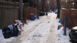
  • West  Brookine / West Canton 
  • West Brookline / Pembroke 
    • Some maps label this as Public Alley 525, but for a reason yet to be determined, it is not considered a "Public Alley" by the city when it comes to paving, etc.  Requires more research into this situation.
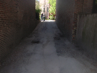
  • Alley between Warren Ave and Columbus Ave.  This is a narrow pedestrian alley with no vehicle access.


In 2011, our neighbors in the Rutland Square Association  repaved the private alley between W. Newton and Rutland Square. See more information on their blog, including excellent FAQs.

Rutland Alley Conversion Report
Rutland Letter to abutters explaining private paving
Boston.com Public vs Private article


A City Council Hearing was held Councilors Arroyo & Linehan regarding the impact of Private Alleys, and the process required to change an alley from private to  public.   The hearing was held April 27, 2011.   See Flyer.     
News Coverage of the hearing:
* South End News May 2011 (See New Link   to .pdf version)
* Universal Hub

* Patch
* Boston.com


Three Key Questions we need to understand regarding Alleys, according to Para Jayashinghe (DPW) and Jim Stearns (BWSC):  (to be filled in as facts are gathered)

Alley (Name)
Public or Private (Official reference/map, etc)
Ref
Sewer / Storm Drain Public or Private (Official Reference)
Ref
Open to Public  Travel (Official Reference)
Ref
Canton/Brookline
Private
?
Private


Brookline/Pembroke (525)
Private
?
BWSC
Past calls to BWSC


Pembroke/Newton
Private
?


Follow alley updates and PBNA news on Twitter.
Follow Pilotblock on Twitter


Return Home


Rutland Square rreport on alley conversion:   http://alleyfix.blogspot.com/2011/01/alley-conversion-report.html

ALLEY CONVERSION
June 3, 2010

SPECIFICATIONS

In order to be accepted as a public way, the alley would have to meet standards set by the Fire Department and the American Disabilities Act.

The existing alley measures 14 to 18 feet.  Fire Department code requires 20 feet.  This would be measured from the midline of the alley.  In addition, regulations require sidewalks measuring 4 feet on each side of the road, making a total of 28 feet.  This would mean that the Public Way would extend approximately 14 feet into each property starting at the centerline, an increase of 5 to 7 feet.

All utility poles and lighting poles must be moved.  Often construction uncovers the need for new sewer lines.

THE BIG QUESTION

The Public Improvement Commission has had no petitions for turning an alley into a public way since the new Fire Department standards were set, or since the passage of the American Disabilities Act (ADA).   It is not clear whether the Commission would insist on these requirements.  It is possible to negotiate waivers with the Fire Department and with the Architectural Access Board, which oversees the ADA.  It could be that our alley would be the test case.

WHO PAYS FOR WHAT

The city covers completely the cost of an engineering study and for the preparation of specifications and planning.

The cost of construction is split evenly with the city.  The betterment of property is determined by the frontage and the area of the land up to a depth of no more than 100 feet from the street.

If new sewer lines are needed, the Department of Public works covers 25 percent of the cost; the rest is the responsibility of abutters.

Abutters are billed when construction is complete.  They pay off the charge in one payment with no interest or they may use a 10-year or 20-year installment agreement including interest.

THE BOTTOM LINE

Given all the variables, it is not possible to nail down a number.  The working estimate is $500,000 or about $5,000 per abutter.

Once the road is accepted as a public way, the City will maintain it.  It will not move it up in the snow plowing priority list.


STEP BY STEP

   1. Collect signatures of 75 to 80 percent of abutters and present petition to the Public Improvement Commission.
   2. The Commission may order an engineering report.  The cost of this report is paid by the city.  Included in this report are the surveying of existing conditions, a plan and profile for the street and its proposed grade of edgestone.
   3. Betterment assessments are figured and apportioned to land owners.
   4. When plans are completed, they are presented to the Commission.  The Commission can vote to approve or reject the proposal.  It can also vote to conduct a preliminary hearing before a public hearing or to defer indefinitely.
   5. In most instances, the Commission votes to advertise for a Public Hearing to move the process forward.
   6. An Order of Notice is prepared and published in two papers.
   7. Abutters are notified.
   8. Betterment assessments are levied.
   9. A Public Hearing is held at which abutters vote for or against changing the designation from Private Way to Public Way.
  10. Based on the abutters vote, the Commission votes to accept or reject the alley as a Public Way.
  11. The Commission instructs the Public Works Commissioner to prepare construction specifications and plans for street improvement.
  12. The street is put into a Highway Construction Contract.
  13. The work is done.
  14. The Executive Secretary forwards the new assessments to the City Assessor and the Collector of Taxes to be levied.


DECISION POINTS

   1. The first decision would be to proceed with a petition and presentation of that petition to the Commission.  The Commission would then decide to carry it forward through the planning stages at no cost or obligation to abutters.
   2. The next decision would be the voting at the Public Hearing of Abutters.  If the vote is to go forward and the Commission agrees, abutters sit back, watch the construction and do nothing until it is time to pay the bill.


Return Home


info@pilotblock.org
© Copyright  2011 Pilot Block Neighborhood Association